As previously mentioned I live 10 kms east of Tha Ton and ride out into the mountains purely as a form of enjoyment. Yes, I have to ride over to supermarkets in Fang and occasionally go down to Chiang Mai to visit my son but wanting to enjoy the journey is more important than speed or the quickest route.
Today I put together 3 rides that I have done before separately, just to make a 5 hour trip and see what changes have been going on. I’ll describe it from Fang because it makes more sense that someone visiting the district would stay there. I know David Unkovich has a few hotels and night spots that he enjoys in Fang and they are probably listed on GTRider.
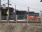
Taking the 107 heading toward Chiang Mai ride just 5 or 6 kms out of town and turn left at the traffic lights where its signed 109 to Mae Suai. It’s a road used by a few big trucks so quite wide with a decent road surface for most of its length but watch out for those spots where the heavy storms have caused landslips so often that they don’t bother to repair the surface properly. After just a few kms North Thailands one and only oil field appears on the left and its still quite a big operation with tankers coming and going regularly.

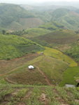
All along this route is agriculture in one form or another. At first Thai farmers with orchards and bananas to complement their ground crops and once you start the climb up the mountain its Lahu hilltribe who unfortunately have cleared most of the trees and planted cash crops on very steep slopes.

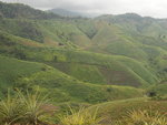
I came through here once in April a few years back and the whole area was black from burn off and still smoking. Right now, October, it looks green and fresh. Down the far side towards Mae Suai there’s more trees with rubber and fruit breaking up the familiar corn fields.


A waterfall is signed on the left which I didn’t try for and right next to it a Akha coffee plantation. That first section is about 60kms.
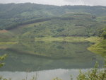
The 109 finally ends at a T junction with the 118, highway to Chiang Rai. Go left at the lights here and just 3 kms along is a big sign showing Doi Chang and Wawee (or Wawi) again to the left. This road, the 3031, varies a bit from excellent to average road surface, a few pot holes and the normal sand and stones washed down when it rains. At first you go up and around the Mae Suai reservoir, coming down at the far end where it’s no more than a flooded river.

With the road sticking to the slightly elevated right bank there is the most ridiculous set of curves sweeping left, right, left, right, a lovely bit of fun. This is no longer the poor countryside that I first came through 10 years ago. The villages are bigger, the houses newer and the road improved with some local shops and businesses that appear to be flourishing.

I can only assume that the rubber and corn have provided cash crops to add to the food they were already growing and maybe even a few tourists are coming through on the long winter holidays.
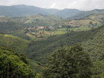
Once you start getting up into the mountains the air is scented with pine trees and the pine forest makes a pretty sight. Some corners here are very tight and if downhill too, then its easy to mess it up. Just like the lowland Thai residents gave way to hilltribes, once you get farther north the Chinese become prominent. This is the KMT who escaped communist China by crossing the border and moving south into Thailand and Burma, the people who introduced tea and poppies to the local crops and who are still responsible for the small army checkpoints you still pass through near the entrance to villages. Wawi is the location of the biggest residential village in these hills with hilltribes and Chinese mixed together, Buddhists, Christians and Muslims all with religious buildings and apparently getting on without violence. Some big new school buildings up here, a tea factory and a tourist resort. Some of the road is newly paved, crash barriers added and new electric pylons grace the skies. A lot of modernization going on. Wawi is just off the road to the left, probably a good place for a Chinese snack of noodles or steamed buns.

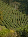
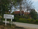
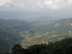
Still climbing uphill, Lao Lee resort and tea plantations come next, followed by a terrific viewpoint where some business minded entrepreneur is placing a café/restaurant by the looks. A big view.


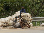
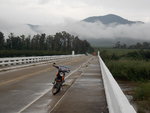
Just along from here a junction on the right is signed to a forest park (Doi Kat Pi?), a road I have been on before but the last bit of dirt road made it hard in the wet but the locals, of course, are there with their Honda Waves. Ban Huai Chompu, the village on the route to that park is the only Yao village in this area in case anyone likes hilltribes. This junction is where the 3031 drops all the way down to the Kok River, a steep road with one awful sharp turn just ½ kms down and another way down near Mae Salak overlooking the Kok. 4kms after crossing the Kok river you come to the highway 107 where another left leaves you heading to Tha Ton. Perhaps 90kms, I didn’t clock it.

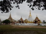
Just 5 kms down the 107 is a big orange farm, Thanathorn, and a left directly opposite takes you back over the Kok river and onto a small country road to Fang that I sometimes use just to leave the heavy traffic behind. The 3023 just links one country village to the next one, surrounded by rice fields and orchards and winds its way to Fang running almost parallel to the 107 without any of the trucks and buses. A few more 90 degree bends that keep you concentrating and a big Shan style temple maybe 4kms before Fang, a style you see more of in the Pai/Mae Hong Son area.

And back where you started, aprox 200 kms and a fair selection of the mountain scenery available, rice, rubber, orchards, tea plantations, markets, villages ,temples, Akha, Lahu, Lisu, KMT, Shan and Thai. Cold beer and food almost anywhere, what more could you want? Keep the power on, as the man says.


Today I put together 3 rides that I have done before separately, just to make a 5 hour trip and see what changes have been going on. I’ll describe it from Fang because it makes more sense that someone visiting the district would stay there. I know David Unkovich has a few hotels and night spots that he enjoys in Fang and they are probably listed on GTRider.
Taking the 107 heading toward Chiang Mai ride just 5 or 6 kms out of town and turn left at the traffic lights where its signed 109 to Mae Suai. It’s a road used by a few big trucks so quite wide with a decent road surface for most of its length but watch out for those spots where the heavy storms have caused landslips so often that they don’t bother to repair the surface properly. After just a few kms North Thailands one and only oil field appears on the left and its still quite a big operation with tankers coming and going regularly.
All along this route is agriculture in one form or another. At first Thai farmers with orchards and bananas to complement their ground crops and once you start the climb up the mountain its Lahu hilltribe who unfortunately have cleared most of the trees and planted cash crops on very steep slopes.
I came through here once in April a few years back and the whole area was black from burn off and still smoking. Right now, October, it looks green and fresh. Down the far side towards Mae Suai there’s more trees with rubber and fruit breaking up the familiar corn fields.
A waterfall is signed on the left which I didn’t try for and right next to it a Akha coffee plantation. That first section is about 60kms.
The 109 finally ends at a T junction with the 118, highway to Chiang Rai. Go left at the lights here and just 3 kms along is a big sign showing Doi Chang and Wawee (or Wawi) again to the left. This road, the 3031, varies a bit from excellent to average road surface, a few pot holes and the normal sand and stones washed down when it rains. At first you go up and around the Mae Suai reservoir, coming down at the far end where it’s no more than a flooded river.
With the road sticking to the slightly elevated right bank there is the most ridiculous set of curves sweeping left, right, left, right, a lovely bit of fun. This is no longer the poor countryside that I first came through 10 years ago. The villages are bigger, the houses newer and the road improved with some local shops and businesses that appear to be flourishing.
I can only assume that the rubber and corn have provided cash crops to add to the food they were already growing and maybe even a few tourists are coming through on the long winter holidays.
Once you start getting up into the mountains the air is scented with pine trees and the pine forest makes a pretty sight. Some corners here are very tight and if downhill too, then its easy to mess it up. Just like the lowland Thai residents gave way to hilltribes, once you get farther north the Chinese become prominent. This is the KMT who escaped communist China by crossing the border and moving south into Thailand and Burma, the people who introduced tea and poppies to the local crops and who are still responsible for the small army checkpoints you still pass through near the entrance to villages. Wawi is the location of the biggest residential village in these hills with hilltribes and Chinese mixed together, Buddhists, Christians and Muslims all with religious buildings and apparently getting on without violence. Some big new school buildings up here, a tea factory and a tourist resort. Some of the road is newly paved, crash barriers added and new electric pylons grace the skies. A lot of modernization going on. Wawi is just off the road to the left, probably a good place for a Chinese snack of noodles or steamed buns.
Still climbing uphill, Lao Lee resort and tea plantations come next, followed by a terrific viewpoint where some business minded entrepreneur is placing a café/restaurant by the looks. A big view.
Just along from here a junction on the right is signed to a forest park (Doi Kat Pi?), a road I have been on before but the last bit of dirt road made it hard in the wet but the locals, of course, are there with their Honda Waves. Ban Huai Chompu, the village on the route to that park is the only Yao village in this area in case anyone likes hilltribes. This junction is where the 3031 drops all the way down to the Kok River, a steep road with one awful sharp turn just ½ kms down and another way down near Mae Salak overlooking the Kok. 4kms after crossing the Kok river you come to the highway 107 where another left leaves you heading to Tha Ton. Perhaps 90kms, I didn’t clock it.
Just 5 kms down the 107 is a big orange farm, Thanathorn, and a left directly opposite takes you back over the Kok river and onto a small country road to Fang that I sometimes use just to leave the heavy traffic behind. The 3023 just links one country village to the next one, surrounded by rice fields and orchards and winds its way to Fang running almost parallel to the 107 without any of the trucks and buses. A few more 90 degree bends that keep you concentrating and a big Shan style temple maybe 4kms before Fang, a style you see more of in the Pai/Mae Hong Son area.
And back where you started, aprox 200 kms and a fair selection of the mountain scenery available, rice, rubber, orchards, tea plantations, markets, villages ,temples, Akha, Lahu, Lisu, KMT, Shan and Thai. Cold beer and food almost anywhere, what more could you want? Keep the power on, as the man says.


Last edited by a moderator:
