My first post to the new site - I have created my own personal blog with "reprints" of posts here and other info. Its still WIP, but there are some features such as gallery and interactive maps that I can't port over from wordpress. Sorry, about the image size. Is there an image format menu for images ?
------------------------------------------------------------------------------------------------------------------------------------------------------
Perak, Malaysia - I have become increasingly amazed at the beauty of this area of Northern Malaysia. The contrast in the environment as you cross the border from Thailand. How the Thais must have totally devastated their rainforest and how well the Malays seem on the face of it, have managed their natural resources.
After researching on google earth, you can see the maze of logging tracks ploughing into the interior and surroundings of Lake. The area is still populated by ethnic Malaysian's known as 'Orang Aslii' who on the whole, still live off the land in their traditional way. A perfect place for an adventure.

It seems that these days we can’t travel 10 km in Thailand without finding a PTT gas station, Seven-11 or a Tesco express - usually located next to one another in a row. The sparsely populated state of Perak still has an old-fashioned feel, many towns still a lazy Chinese vibe.
This is my second visit to the area, the first into The Royal Belum State Park, and this subsequent visit, six weeks later into an area further south into the state.
As you ride along Rte.76, the brown tourist signposts announce the area as The Lake District and areas of archeological interest. It appears my recent trips into the area haven’t even scraped the surface. Studying Google Earth, I already have a couple more trips planned along winding logging tracks heading into the interior.
From a riders’ point of view, the trunk roads are great, very little traffic on the roads which are in a good condition, the road users courteous.
This area, appears to be gradually deforested and replaced by palm plantations, but a lot of the original rain forest remains. The area is still home to over fifty aboriginal settlements home to the 'Orang Aslii'.
THE NORTH OF THE SOUTH
I was following a report from a Malaysian rider - Mohd Rashidin - on Rideasia.net. As my time for riding was running short I loaded up the bike with supplies and headed out. I had a rough route in my head, but little time to plan a route or load up the GPS other than a couple of landmarks on the eTrex.

I left Hat Yai at around 7.00 AM, taking the road to Betong arriving around 10.00. I had a few things to do in town, and made it to the border at around 12.00 ( +1 hr. in Malaysian time ). I checked out of Thailand without any trouble and went to purchase insurance.
Instead of using the agent on the roadside, as I had done on a previous trip, I went directly to the shop that the agent had used. Unfortunately, every time I have the need to purchase this compulsory insurance to enter Malaysia, the agents occupy over an hour of valuable time.
Further details of crossing into Malaysia at the Betong post can be found here.
After receiving my insurance cover, I continued to the Malaysian immigration complex. The JPJ official seemed to be wasting time entering others details into the computer on this occasion, and his superior who recognized me from a previous visit came over and hurried him up, even then the JPJ process seemed to take a further forty minutes.
On this occasion, I took the single carriage - 1157, Jalan Lapang Nering road, which avoids the entering Pengkalan Hulu and entered Gerik to fill up with petrol.
After the delay of 2 hours on entering Malaysia, I chose to make journey the Cameron Highlands. I had no idea of a camp site, hotel or guest house in the area and knew from prior research I would find at least one campsite.
The 200 km run to Ipoh was fast ( on the motorway ) and painless ( also with the current price of petrol in Malaysia, rather cheap ). I found a campsite quite by accident after a bit of riding and slept the night.
The next morning, I packed up and headed back to the planned destination. The details were still quite sketchy.
Without a Malaysian SIM, I had no google maps and it was hard going relying solely on the Garmin. I had some notes "Pengakaln Hulu > 76 > Gerik > Lenggong > Sauk > Kuala Kangsar > Sungai Siphut > Lasah" apart from that I was flying blind. I rode into Lasah, took on water and asked for directions to Kuala Mu. Every shop gave me a blank look and I thought about turning back, on my third stop, there was a discussion and the result was .. ride for 5 minutes and take the road to the right.
Quite unbelievably, the tarmac just stopped and there, on the side of the road was a fork in the grey rock road was a bright orange sign directing me uphill to Pos Kuala Mu. The slight slope ended in a broken concrete section and then the ochre laterite road began.

I saw graders working the road, and trucks ploughing back and forth along the dust road. I felt quite relieved, knowing the point from the end of tarmac to Pos Kuala Mu was 20km and after doing a few calculations in my head that maybe in an hours time ( allowing for time to drink water and take photos ) I could be sitting in my tent with a cup of tea in hand.
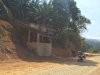
Further along the road concrete crews were working on roadside drainage, and electricity crews installing single power cable. Every stop, people pointed to assure me I was on the right track. I rode past several well-kept Orang Aslii villages with a some of traditional bamboo and thatch longhouses and some newer settlements of brick construction.
At a bend of a road, a tarmac road led down to a settlement with a school. I knew from previous adventures the tarmac road isn’t the way, nothing is this easy and probably the route is just a dead-end path down to the well organized village below.

Finally, I reached a very well constructed ascent road and continued onwards and upwards. Unfortunately, I as I proceeded I realized the LCD screen of the eTrex was pointing in the opposite path from Kuala Mu and that I should have taken the downwards path.
I span the bike around and headed over a steel bridge, checked with the guys on the steel bridge and entered the landmark on the GPS.

As I rode around the corner, I realized that this was the workers camp, as described in Mohd's blog post, I turned the corner and realized the time target of 1 hour wasn't going to be achievable.

The road in front of me was a sheer uphill ascent, the road constructed of loose rock - the only redeeming factor was a compacted and polished ridge in between the 4WD tracks that was the path for motorbikes.
I motored up the hill in first and reached the corner, expecting to see a downwards slope I was surprised to see another sheer face - with no where to stop I continued to the next corner, only to repeat the process again and again for what seemed like over a kilometer.
This was becoming a bit serious, I had no idea of the angle but I knew coming down was going to be an issue.
The road eventually levelled out into manageable alternate uphill and downhill runs. I was enjoying myself, as the local community waved as they rode past on their scooters and the local government 4WD's stopped to chat and make sure I was OK.
The palm plantations and de-forested hills gave way to thick jungle with the occasional glimpse of the thick tree cover in the valleys below.

At around 4.00 PM I turned a corner and saw that the lacerite had become a burnt orange clay constancy. It looked like the area had had some recent rain and I turned the corner to be faced with another steep uphill. The back wheel started to slip and after the next bend, I chose the wrong path and ended up slipping into the soft clay in the middle of the 4WD tracks, the back and spun around and it was time to lay the bike down.
Luckily within a couple of minutes I saw a pickup at the top of the hill. I signaled to the driver not to proceed and he parked up and came down to see what this crazy white guy was doing in the middle of the jungle.
"What are you doing ?" with a big smile, he helped me upright the bike and we talked. He said there had been recent heavy rainfall and he too was trying to get to Kuala Mu, but had turned back, allowing his workers to continue on foot to the village.
The guys returned and we bumped the bike down the hill and turned it around. Mobile phones were produced and a photo session begun.
They informed me that it was impossible to make it to Kuala Mu today, that one charity worker I had seen earlier braved the last hill by attaching his winch line to a tree at the top and pulled himself up the hill. Taking his passenger, an elderly woman coming back from hospital down to the village.

They advised me that I could stay at any of the other villages and followed me as i slipped over the next few hills. I found a soft and level verge and decided to call this home for the night and pitched my tent and finally got my long awaited cup of tea.
The brave 4WD driver returned on his outgoing journey and checked to see if I was OK.
The jungle is a weird place at night - I awoke to see flashing lights on my tent, I was relieved it wasn’t bandits but a silent electrical storm and later I heard the sound of thunder. I counted down the seconds while crossing my fingers, and it seemed after a while time between the loud crack of thunder was growing. I really didn’t need any rain falling further along the track at the steep descent in the morning. Luckily the storm passed and I nodded back to sleep.
The jungle is also a very noisy place, I was awoken by a loud buzzing sound, luckily it was outside the tent but a team of drones had discovered my tent and were buzzing around, natures alarm clock.
I loaded the bike and headed off after a couple of cups of coffee.
As I stopped for a mouthful of water, the guys who assisted me the previous day appeared in their truck. I discovered, were from a company building a hydro-project in the area came around the corner. They had brought me breakfast, Roti Canai, I felt most humbled, but having already eaten pancakes, I stored it for my lunch. We chatted and exchanged details, followed by another photo shoot. Great guys, I am happy to have bumped into them and hope to meet again in the future.

They informed me that after they left me the previous evening that the long straight road had been hit by the same rain storm, and I would have had difficulty getting down the track to cross the steel bridge. I had made the best of a bad situation.
As I rode on the eTrex told me it was about three and a half enjoyable kilometers to the steel bridge but as I turned the corner and I knew the downhill stretch was coming. Turn after turn of loose downhill balancing on the smooth strip. Eventually hitting the worst stretch of broken potholed cement and loose rock, rolling out onto the workers camp below. I had done the descent without a fall ! Although releived, I couldn’t believe it.
Looking back at the GPS Data - The drop was a total of 2.1 km, by far the longest steep drop I have ever had to conquer.
I stopped at the steel bridge for a mouthful of water and a few photos.


The rest of the journey was plain sailing. Knowing the terrain, I got up on the pegs and accelerated along the long orange track while the bike skipped around underneath me.
Yet again, my final destination evaded me - But I will return next year.
WHERE TO STAY
There seem to be a few guest houses or homestays ( Malaysian for B&B ) in Sungai Siput. I saw a rather modern guesthouse on the outskirts of town heading towards Rte.76. If you were in need to collect provisions, then Sungai Siput would be the ideal place, with a well stocked high street.
There is a petrol station, in Lasah (N4.95659° E101.13004° Estimated)
GETTING THERE AND AWAY
Pos Kuala Mu is situated in Perak Province, Northern Malaysia around 170 km from the Thai border, a short distance from Rte.76. Kuala Lumpur is situated around 250 km, the Cameron Highlands around 150 km and Ipoh around 50 km. The journey from the South is quite painless as you can use the AH2 motorway.
To join Rte.76 from Penang or Kota Bahru, take the E-W Timur-Barat highway ( Rte.4 ) and join Rte.76 at Gerik, 125 km.
FURTHER INFO
I found this well polished video about Perak state from the local tourist agency.
------------------------------------------------------------------------------------------------------------------------------------------------------
Perak, Malaysia - I have become increasingly amazed at the beauty of this area of Northern Malaysia. The contrast in the environment as you cross the border from Thailand. How the Thais must have totally devastated their rainforest and how well the Malays seem on the face of it, have managed their natural resources.
After researching on google earth, you can see the maze of logging tracks ploughing into the interior and surroundings of Lake. The area is still populated by ethnic Malaysian's known as 'Orang Aslii' who on the whole, still live off the land in their traditional way. A perfect place for an adventure.
It seems that these days we can’t travel 10 km in Thailand without finding a PTT gas station, Seven-11 or a Tesco express - usually located next to one another in a row. The sparsely populated state of Perak still has an old-fashioned feel, many towns still a lazy Chinese vibe.
This is my second visit to the area, the first into The Royal Belum State Park, and this subsequent visit, six weeks later into an area further south into the state.
As you ride along Rte.76, the brown tourist signposts announce the area as The Lake District and areas of archeological interest. It appears my recent trips into the area haven’t even scraped the surface. Studying Google Earth, I already have a couple more trips planned along winding logging tracks heading into the interior.
From a riders’ point of view, the trunk roads are great, very little traffic on the roads which are in a good condition, the road users courteous.
This area, appears to be gradually deforested and replaced by palm plantations, but a lot of the original rain forest remains. The area is still home to over fifty aboriginal settlements home to the 'Orang Aslii'.
THE NORTH OF THE SOUTH
I was following a report from a Malaysian rider - Mohd Rashidin - on Rideasia.net. As my time for riding was running short I loaded up the bike with supplies and headed out. I had a rough route in my head, but little time to plan a route or load up the GPS other than a couple of landmarks on the eTrex.
I left Hat Yai at around 7.00 AM, taking the road to Betong arriving around 10.00. I had a few things to do in town, and made it to the border at around 12.00 ( +1 hr. in Malaysian time ). I checked out of Thailand without any trouble and went to purchase insurance.
Instead of using the agent on the roadside, as I had done on a previous trip, I went directly to the shop that the agent had used. Unfortunately, every time I have the need to purchase this compulsory insurance to enter Malaysia, the agents occupy over an hour of valuable time.
Further details of crossing into Malaysia at the Betong post can be found here.
After receiving my insurance cover, I continued to the Malaysian immigration complex. The JPJ official seemed to be wasting time entering others details into the computer on this occasion, and his superior who recognized me from a previous visit came over and hurried him up, even then the JPJ process seemed to take a further forty minutes.
On this occasion, I took the single carriage - 1157, Jalan Lapang Nering road, which avoids the entering Pengkalan Hulu and entered Gerik to fill up with petrol.
After the delay of 2 hours on entering Malaysia, I chose to make journey the Cameron Highlands. I had no idea of a camp site, hotel or guest house in the area and knew from prior research I would find at least one campsite.
The 200 km run to Ipoh was fast ( on the motorway ) and painless ( also with the current price of petrol in Malaysia, rather cheap ). I found a campsite quite by accident after a bit of riding and slept the night.
The next morning, I packed up and headed back to the planned destination. The details were still quite sketchy.
Without a Malaysian SIM, I had no google maps and it was hard going relying solely on the Garmin. I had some notes "Pengakaln Hulu > 76 > Gerik > Lenggong > Sauk > Kuala Kangsar > Sungai Siphut > Lasah" apart from that I was flying blind. I rode into Lasah, took on water and asked for directions to Kuala Mu. Every shop gave me a blank look and I thought about turning back, on my third stop, there was a discussion and the result was .. ride for 5 minutes and take the road to the right.
Quite unbelievably, the tarmac just stopped and there, on the side of the road was a fork in the grey rock road was a bright orange sign directing me uphill to Pos Kuala Mu. The slight slope ended in a broken concrete section and then the ochre laterite road began.
I saw graders working the road, and trucks ploughing back and forth along the dust road. I felt quite relieved, knowing the point from the end of tarmac to Pos Kuala Mu was 20km and after doing a few calculations in my head that maybe in an hours time ( allowing for time to drink water and take photos ) I could be sitting in my tent with a cup of tea in hand.
Further along the road concrete crews were working on roadside drainage, and electricity crews installing single power cable. Every stop, people pointed to assure me I was on the right track. I rode past several well-kept Orang Aslii villages with a some of traditional bamboo and thatch longhouses and some newer settlements of brick construction.
At a bend of a road, a tarmac road led down to a settlement with a school. I knew from previous adventures the tarmac road isn’t the way, nothing is this easy and probably the route is just a dead-end path down to the well organized village below.
Finally, I reached a very well constructed ascent road and continued onwards and upwards. Unfortunately, I as I proceeded I realized the LCD screen of the eTrex was pointing in the opposite path from Kuala Mu and that I should have taken the downwards path.
I span the bike around and headed over a steel bridge, checked with the guys on the steel bridge and entered the landmark on the GPS.
As I rode around the corner, I realized that this was the workers camp, as described in Mohd's blog post, I turned the corner and realized the time target of 1 hour wasn't going to be achievable.
The road in front of me was a sheer uphill ascent, the road constructed of loose rock - the only redeeming factor was a compacted and polished ridge in between the 4WD tracks that was the path for motorbikes.
I motored up the hill in first and reached the corner, expecting to see a downwards slope I was surprised to see another sheer face - with no where to stop I continued to the next corner, only to repeat the process again and again for what seemed like over a kilometer.
This was becoming a bit serious, I had no idea of the angle but I knew coming down was going to be an issue.
The road eventually levelled out into manageable alternate uphill and downhill runs. I was enjoying myself, as the local community waved as they rode past on their scooters and the local government 4WD's stopped to chat and make sure I was OK.
The palm plantations and de-forested hills gave way to thick jungle with the occasional glimpse of the thick tree cover in the valleys below.
At around 4.00 PM I turned a corner and saw that the lacerite had become a burnt orange clay constancy. It looked like the area had had some recent rain and I turned the corner to be faced with another steep uphill. The back wheel started to slip and after the next bend, I chose the wrong path and ended up slipping into the soft clay in the middle of the 4WD tracks, the back and spun around and it was time to lay the bike down.
Luckily within a couple of minutes I saw a pickup at the top of the hill. I signaled to the driver not to proceed and he parked up and came down to see what this crazy white guy was doing in the middle of the jungle.
"What are you doing ?" with a big smile, he helped me upright the bike and we talked. He said there had been recent heavy rainfall and he too was trying to get to Kuala Mu, but had turned back, allowing his workers to continue on foot to the village.
The guys returned and we bumped the bike down the hill and turned it around. Mobile phones were produced and a photo session begun.
They informed me that it was impossible to make it to Kuala Mu today, that one charity worker I had seen earlier braved the last hill by attaching his winch line to a tree at the top and pulled himself up the hill. Taking his passenger, an elderly woman coming back from hospital down to the village.
They advised me that I could stay at any of the other villages and followed me as i slipped over the next few hills. I found a soft and level verge and decided to call this home for the night and pitched my tent and finally got my long awaited cup of tea.
The brave 4WD driver returned on his outgoing journey and checked to see if I was OK.
The jungle is a weird place at night - I awoke to see flashing lights on my tent, I was relieved it wasn’t bandits but a silent electrical storm and later I heard the sound of thunder. I counted down the seconds while crossing my fingers, and it seemed after a while time between the loud crack of thunder was growing. I really didn’t need any rain falling further along the track at the steep descent in the morning. Luckily the storm passed and I nodded back to sleep.
The jungle is also a very noisy place, I was awoken by a loud buzzing sound, luckily it was outside the tent but a team of drones had discovered my tent and were buzzing around, natures alarm clock.
I loaded the bike and headed off after a couple of cups of coffee.
As I stopped for a mouthful of water, the guys who assisted me the previous day appeared in their truck. I discovered, were from a company building a hydro-project in the area came around the corner. They had brought me breakfast, Roti Canai, I felt most humbled, but having already eaten pancakes, I stored it for my lunch. We chatted and exchanged details, followed by another photo shoot. Great guys, I am happy to have bumped into them and hope to meet again in the future.
They informed me that after they left me the previous evening that the long straight road had been hit by the same rain storm, and I would have had difficulty getting down the track to cross the steel bridge. I had made the best of a bad situation.
As I rode on the eTrex told me it was about three and a half enjoyable kilometers to the steel bridge but as I turned the corner and I knew the downhill stretch was coming. Turn after turn of loose downhill balancing on the smooth strip. Eventually hitting the worst stretch of broken potholed cement and loose rock, rolling out onto the workers camp below. I had done the descent without a fall ! Although releived, I couldn’t believe it.
Looking back at the GPS Data - The drop was a total of 2.1 km, by far the longest steep drop I have ever had to conquer.
I stopped at the steel bridge for a mouthful of water and a few photos.
The rest of the journey was plain sailing. Knowing the terrain, I got up on the pegs and accelerated along the long orange track while the bike skipped around underneath me.
Yet again, my final destination evaded me - But I will return next year.
WHERE TO STAY
There seem to be a few guest houses or homestays ( Malaysian for B&B ) in Sungai Siput. I saw a rather modern guesthouse on the outskirts of town heading towards Rte.76. If you were in need to collect provisions, then Sungai Siput would be the ideal place, with a well stocked high street.
There is a petrol station, in Lasah (N4.95659° E101.13004° Estimated)
GETTING THERE AND AWAY
Pos Kuala Mu is situated in Perak Province, Northern Malaysia around 170 km from the Thai border, a short distance from Rte.76. Kuala Lumpur is situated around 250 km, the Cameron Highlands around 150 km and Ipoh around 50 km. The journey from the South is quite painless as you can use the AH2 motorway.
To join Rte.76 from Penang or Kota Bahru, take the E-W Timur-Barat highway ( Rte.4 ) and join Rte.76 at Gerik, 125 km.
FURTHER INFO
I found this well polished video about Perak state from the local tourist agency.
Last edited: