Lahu Village, Doi Cha An, Near Doi Laem Loop (1314)

Steve Merchant

0
Subscribed
Dec 11, 2009
132
209
43
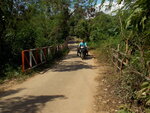
Several years ago when the weather was fine and I had free time on my hands I took a trip into the Doi Pha Hom Pok national park on a route signed off the 1089 as the way to The Little House in the Big Forest. On the way up the mountain there was a clear view of a village sitting across the valley right on the edge of the escarpment. As an ex overland adventure driver I have a bad habit of wanting to get to these distant places just to see whats there and for a few years that place has weighed on my mind. I’ve checked its position out on google maps, gone back to the area and had a look and earlier this year was back on the same route up to the Little House when I did the write up on the newly poured concrete road that runs up from Fang bypass to the Pha Hom Pok campsite, around the mountain to Little House and then down to the 1089 at Pa Sang.

I did actually find a route I was told would take me there but the entry was from the National Park and they wanted a 300b fee. Then I found another route at the start of the rainy season and once the track got wet, the deep ruts proved too scary for an old man on a 250 Stallions and I turned back.

With the morning starting a bit misty, a usual sign in my village of later sun, I set out this morning to give that route another go. Only 2 kilometers out of Mae Ai on the 1089 to Fang there is a small village tucked behind Wat Doi Keo which is where the track starts. Its not much of a road as it heads out the village north and it narrows even more as it passes a little irrigation pond that has caused 30% of the road to collapse but after that its poured concrete sections for a while and passes some local farms and then a lovely old teak forest. Many trees on the road here have got the orange monk robe wrapped around them so I assume the villagers were wary of a widening plan at one time and tried to protect their forest.

Once you hit the climbs the road often reverts from concrete to mud and sure enough the deep ruts are still there but not such a worry in the dry. As is normal, I realized I was on the right route when young people coming the opposite way on Waves whipped down the hill like it was decent tarmac on their way to college or shopping. There was a few very steep inclines, nothing dangerous, but as the views improved it was impossible to stop the bike for pictures, the slope being just too much to park.

It’s a Lahu village, plenty of these around Pha Hom Pok, in 3 main sections. The first is on the right side of the track nearing the top. The main village is on a decent flat spot with a wide dirt road and a few small shops and that’s where I parked. The third section being straight ahead and down a little (which I walked) with a magnificent view of Pha Hom Pok park and mountain. The most unusual feature of the place is that the whole line of houses through the main village are in the same modern style, like a moo baan. I have never seen a hilltribe village quite like this, like an English council estate. From the first distant views I thought it was maybe military housing, and the map does indicate Thu Thi Ya Pho, Anusarn border patrol which I never did see, probably just on up the mountain a bit.

See this for a view off google maps. Google Maps

The weather was good, for sure up here at this height there was quite a bit of glare making photos a tad difficult, but the views were terrific with lower hills preceding the Mae Ai valley and the distant hills on the far off opposite side in the direction of Wawi. I don’t think I have ever had better views of my district, forests or bamboo clumps usually getting in the way even when you are up at the national park camping grounds, the second highest place in Thailand.

Probably not even 12 kms total from highway to village, less than an hour even with photo stops, a good side trip for people with CRF’s and similar, maybe not for the bigger road bikes that you couldn’t lift out if you slipped into a deep rut. The locals were friendly, lots of dogs and kids, but I have a feeling they don’t see too many passing travelers. For anyone with a dirt bike the maps even show another way into the village, off the right side of the decent paved road that leads to Little House but I was told not to take my CB300F down there, not suitable, so I returned the same way I arrived. Another good half day out of Tha Ton, better than being stuck in city traffic taking the wife shopping.
download (4).png
DSCN0208.JPG
DSCN0382.JPG
P1100508.JPG
P1100510.JPG
P1100513.JPG
P1100514.JPG
P1100515.JPG
P1100517.JPG
P1100523.JPG
DSCN0380.JPG
 

Attachments

  • DSCN0385.JPG
    DSCN0385.JPG
    326.8 KB · Views: 163
Last edited:

Steve Merchant

0
Subscribed
Dec 11, 2009
132
209
43
The first picture is the view I had 5 years ago when I rode up to Little House. The small thumbnail under attached files is the narrow road on the way in where it passes an irrigation pond, maybe David can place it in the pics as number 2. The rest are in order of the ride.
 
Last edited: