Phu An Ma - Chiang Kham R 1148 - An Amazing Steep Loop

DavidFL

0
Staff member
Subscribed
Jan 16, 2003
14,455
5,287
113
70
Chiang Khong
www.thegtrider.com
Phu An Ma is a majestic 16,58 metres mountain peak off R1148 & behind Phu Langkha, close to the Laos border.
upload_2020-4-1_17-11-14.png

photo from Ian Yonok

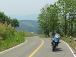
Ian Yonok from Chiang Saen has been to the peak & camped out a night there in his hammock.
His report on GTR is here
Chiang Kham Loop & Phu Arnmar Camping

upload_2020-4-1_17-11-47.png


Last year in May 2019 on a trip back from Pua I thought I’d check out this fantastic little loop off R1148. (I thought I had posted the info, but can’t see it on GTR.)

It is a sensational climb to the top
upload_2020-4-1_17-13-13.png


The turn off on R1148 is at Ban Hae & the police check point.
upload_2020-4-1_17-16-31.png


The route # to take is R4029 & is signposted for Nam Min at first.
upload_2020-4-1_17-16-53.png


Nam Min is a waterfall off to the left & west of R4029 خرائط ‪Google‬‏‏

Further on the signs are for the royal project at the end of the road R4029 خرائط ‪Google‬‏‏
upload_2020-4-1_17-39-17.png


R4029 is a good surface, asphalt at the start and then when going gets touch & super steep soaring up into he mountains it is concrete.
upload_2020-4-1_17-24-31.png


upload_2020-4-1_17-24-43.png


You know you're on the right track when you see the Phu An Ma signs.
upload_2020-4-1_17-25-38.png


upload_2020-4-1_17-25-56.png


Onto the concrete & the road gets narrower and steeper
upload_2020-4-1_17-28-0.png


upload_2020-4-1_17-28-25.png


In May in the heat just chugging along it was boiling hot as it was difficult to carry any speed on the narrow road.

A nice section of road
upload_2020-4-1_17-29-49.png


upload_2020-4-1_17-30-24.png


upload_2020-4-1_17-30-51.png


The road ends in Nong ha, Hmong village where there is a forestry office & a royal project.
Both my phone & camera battery ran out, so that was it for photos.

But it is a beautiful ride out straight into Chiang Kham via R1345
upload_2020-4-1_18-2-20.png


On the way I passed the turn off to Phu An Ma peak, & was not sure of the road conditions - was it concrete or dirt all the way to the top. If it was dirt I'd have trouble turning the Vstrom around on a steep slope. So feeling over heated I piked out on the last 1kms to Phu An Ma.
But when I got home & checked out Ian's photos gain, I knew I should have ridden up.
A return trip is required.

Phu An Ma is 26 kms from R1148 and 36 kms from Chiang Kham.
You can spend at least 1.5 hours in here riding for the loop + another 1.5 hours minimum should you tackle the actual peak.
Check it out some time. It is an amazing little ride.

Phu An Ma is located here on google maps

خرائط ‪Google‬‏‏
 

Attachments

  • upload_2020-4-1_17-26-43.png
    upload_2020-4-1_17-26-43.png
    1.1 MB · Views: 210
  • Like
Reactions: Eoin Christie

ianyonok

0
Subscribed
Dec 9, 2008
1,082
862
113
Yes, Phu Anma is a super spot and the walk up from the car park is not hard, 100m of mostly steps, upnto the ridgeline. Looking east you can see Doi Langka.
The loop is also a great addition if riding the 1148. Rarely any traffic on it.
 
  • Like
Reactions: Eoin Christie

Oddvar

0
Subscribed
Mar 18, 2013
534
358
63
5-6 years ago it was mostly dirt on the top. I was looking for trails taking me east to to join up with "the dead end". Not more than 4 km as the crow flies. But this is more like an eagles land than a crows land.
2-3 years ago they upgraded most of the roads and sealed the missing 2km going towards Chiang Kham.
Screenshot 2020-04-07_11-38-42-155.png