The Ing River
The Ing is a 260 kms river that starts in Phayao province, north of Phayao in Mae Chai district, that flows south into the lake at Phayao.
Then, from the Phayao lake it generally flows northward & into the Mekong near Chiang Khong.
The Ing Watershed is one of the most abundant watersheds in Thailand; & consists of rich natural resources and ecosystem diversity, including forests, mountains, rivers, stream tributaries, and watershed areas.
From
 www.gt-rider.com
The Boon Rueang Wetlands
The Ing Watershed is one of the most abundant watersheds in Thailand. It consists of rich natural resources and ecosystem diversity, including forests, mountains, rivers, stream tributaries, and watershed areas. The 260-kilometer basin river flows from Phayao Province to Chiang Rai Province in Northern part of Thailand before linking to Mekong River. It’s water’s path is interesting in that it basically flows south into the Phayao lake, & then flows out to swing back North into the Mekong at Pak Ing, downstream from Chiang Khong.
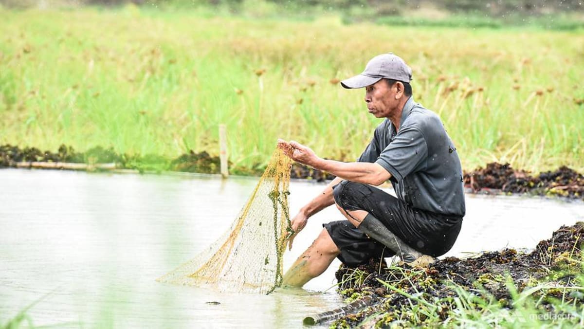
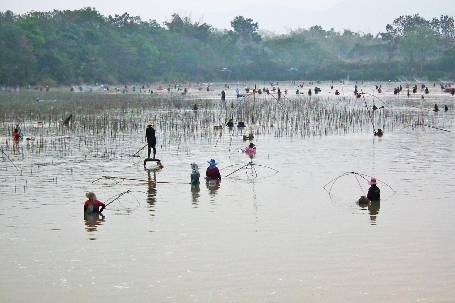
The Ing river communities have shared a close relationship with the watershed since it has nurtured them for centuries. They have developed their local wisdom on natural resource management combined with their way of life. This includes organizing traditional irrigation, community forestry, watershed and fishery zone managements.
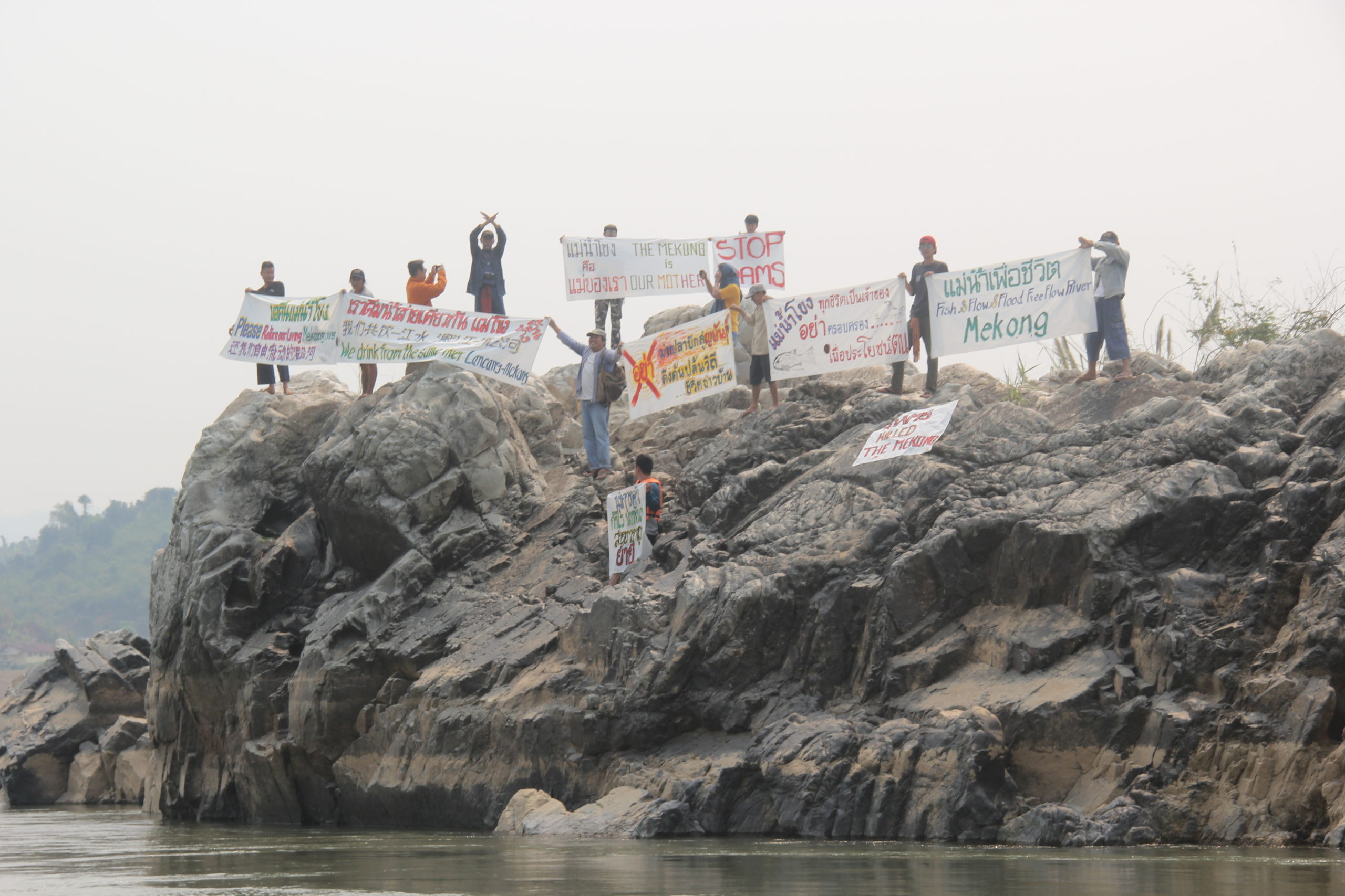
A proposed SEZ in Chiang Rai near Boon Rueang was to use 3,000 – 4,000 rai for an industrial zone, but it united the villages & greatly strengthened their community & resolve to save their environment.
Boon Rueang has a 300 years old village forest that is an important source of food for the local communities. In the wet season the waters of the Ing inundate the river basin, spurring migratory fish to enter the Ing from the larger Mekong to spawn. The flooded forested river banks providing excellent spawning grounds for a wide variety of fish. After the wet, when the river recedes, many young and old fish go back downstream in the dry season.
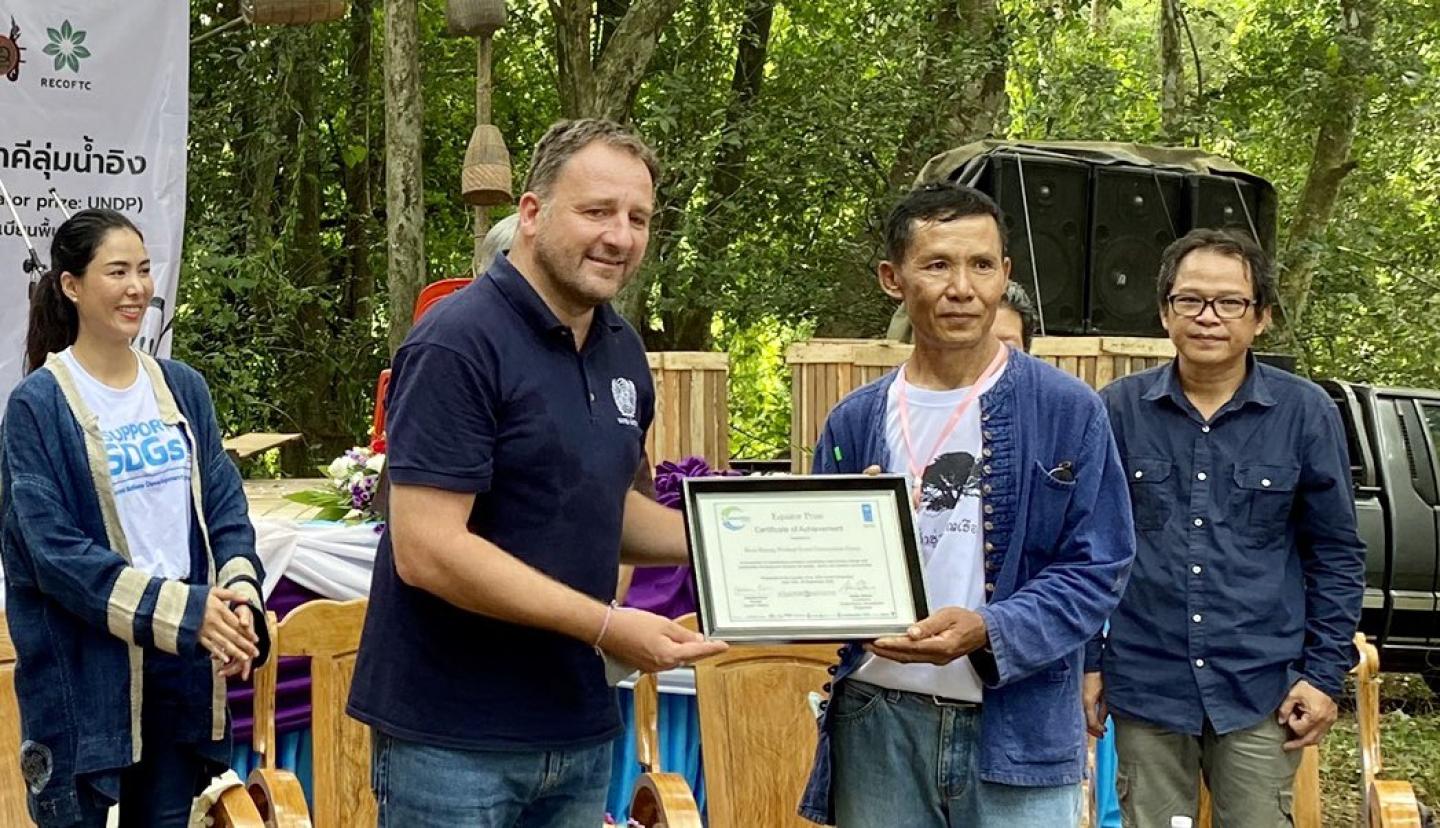
In 2020 The Boon Rueang community has just won a UNDP Equator Prize.
The Equator Prize is awarded roughly every two years to recognise and advance local sustainable development solutions for people, nature, and resilient communities. As local community and indigenous groups across the world chart a path towards sustainable development, the Equator Prize shines a spotlight on their efforts by honouring them on an international stage.
The UNDP awards the US$10,000 prize biennially to recognize outstanding community efforts to reduce poverty through the conservation and sustainable use of biodiversity. As sustainable community initiatives take root, they lay the foundation for achieving the Sustainable Development Goals (SDGs) and overcoming the climate crisis.
Boon Rueang Wetland Forest Conservation Group of Thailand wins global environmental award: The Equator Prize
On Google maps take a look around here
Google Maps
A documentary in Thai indicating all the Ing River wetlands
The size and wealth of the Boon Rueang Wetlands in impressive
Some Logging History & Transportation On The Ing
An interesting bit of history on the Ing, Kok & Fang rivers.
These 3 rivers basically flow South to North & into the Mekong. The only other river in the North to do this is Mae Lao?
In the early Siam logging days, teak was cut & dropped into the rivers of the Chao Phraya watershed to end up in Bangkok.
But not that of the Ing & the Kok, because these rivers flowed into the Mekong watershed & getting the logs over the ridgeline into the other watershed was too difficult.
So what happened & who got the contracts & did the logging - not the Brits & the Borneo Company / Bombay Burmah Trading Corporation / The Siam Forest Company, but the French with French East Asiatic Company who floated the logs down the Ing or the Kok & into the Mekong to eventually end up in Saigon, Vietnam!
The Ing logging concession was given to the French in 1909.
Previously though in 1901 the Bombay Burmah Trading Corporation had the logging concession, but found it too difficult to get the logs into the Chao Phraya watershed by the Yom river.
The solution was for a new logging concession: The Ing forests would be subdivided into three sections north, central, and south forests. The south section, the timbers of which could be worked into the Yom River, was granted to the Siam Forest Company. However, the north and central sections, from where the only feasible export route was via the Mekong watershed, were given to the French East Asiatic Company. And so the timber from Phayao eventually ended up at Saigon in the Mekong!
The Kok Logging Concession was granted in 1912, after the return on the French East Asiatic Company was not commensurate to their investment in the Ing concession. The agreement was that they would harvest the Ing for 15 years and then the Kok for 15 years.
The Fang River that flowed North was an exception though, as the Siamese government of the day was concerned about the French gaining excessive influence and stipulated that the timber of the Fang forests would not be transported along the Mekong River. The Borneo Company had the Fang logging lease and to move the logs out they constructed a tramway on which loaded trucks were drawn by elephants from the final delivery point in the forest to the top of the watershed, and a chute or timber-slide to transport the logs down the precipitous slopes from the highest point on the watershed at the end of the tramway. From 1912 to 1930 teak was transported into Mae Phan and Mae Poi, tributaries of the Ping River in the Chao Phraya watershed. Somewhere on the headwaters of the Fang river there may still be an old tramway cutting?
Transporting Timber from the Ing down the Khong to Saigon
Moving timber out along the meandering Ing was not without difficulty.
The teak was felled in the upper watershed of the Ing River, around Ban Tam Nai, Ban Ronghai and Ban Phin near Phayao town.
Floating the teak out usually started in June / July at the start of the wet when the water level in the Ing was rising.
The logs were floated downstream to Thoeng, where some were processed at a sawmill beside the river, & /or made into rafts.
From Thoeng downstream the river was more difficult and meandering.
Thung Ang 5 kms before the confluence of the Ing & the Mekong, at Thung Ang just east of R1020 & west of R1155 Google Maps there was a huge horseshoe bend in the river that caused log jams so the French cut a canal through to alleviate the problem. This big bend was also used as a storage yard for logs. (I wonder about all the other bends in the Ing, through the Boon Rueng wetlands?)
Ban Ten 3 kms further downstream at Ban Ten, where there now is a bridge across the Ing, the Royal Forest Department established a duty station to collect taxes on the logs.
Google Maps
Down the Khong In March - April the logs were then floated down the Mekong river. Khamu labourers were used for the journey down the Khong, because of their price & Mekong experience.
The main obstacle on the Khong going downstream was the Khone Phapheng rapids in the south of Laos.
Depending on the season, the log rafts were moored at Don Dek and Don Khone & dismantled to be floated through small channels (wet season), or carried across Don Khone by the train in the dry season.
Overall it took two years for logs to be floated downstream from Chiang Khong to Saigon!
The French East Asiatic Company processed about 4,000 logs annually at two sawmills, one near Saigon and the other near Phnom Penh.
The Ing is a 260 kms river that starts in Phayao province, north of Phayao in Mae Chai district, that flows south into the lake at Phayao.
Then, from the Phayao lake it generally flows northward & into the Mekong near Chiang Khong.
The Ing Watershed is one of the most abundant watersheds in Thailand; & consists of rich natural resources and ecosystem diversity, including forests, mountains, rivers, stream tributaries, and watershed areas.
From
A Dam On The Ing River
Surprised that most of the fabrication of the gates/fences and guard rails are made onsite, back in the West this would be done off site in a workshop and then transported onsite, here welding cutting and grinding, sitting in the open, yesterday was 38 deg :eek:..........................you...
www.gt-rider.com
The Boon Rueang Wetlands
The Ing Watershed is one of the most abundant watersheds in Thailand. It consists of rich natural resources and ecosystem diversity, including forests, mountains, rivers, stream tributaries, and watershed areas. The 260-kilometer basin river flows from Phayao Province to Chiang Rai Province in Northern part of Thailand before linking to Mekong River. It’s water’s path is interesting in that it basically flows south into the Phayao lake, & then flows out to swing back North into the Mekong at Pak Ing, downstream from Chiang Khong.
The Ing river communities have shared a close relationship with the watershed since it has nurtured them for centuries. They have developed their local wisdom on natural resource management combined with their way of life. This includes organizing traditional irrigation, community forestry, watershed and fishery zone managements.
A proposed SEZ in Chiang Rai near Boon Rueang was to use 3,000 – 4,000 rai for an industrial zone, but it united the villages & greatly strengthened their community & resolve to save their environment.
Boon Rueang has a 300 years old village forest that is an important source of food for the local communities. In the wet season the waters of the Ing inundate the river basin, spurring migratory fish to enter the Ing from the larger Mekong to spawn. The flooded forested river banks providing excellent spawning grounds for a wide variety of fish. After the wet, when the river recedes, many young and old fish go back downstream in the dry season.
In 2020 The Boon Rueang community has just won a UNDP Equator Prize.
The Equator Prize is awarded roughly every two years to recognise and advance local sustainable development solutions for people, nature, and resilient communities. As local community and indigenous groups across the world chart a path towards sustainable development, the Equator Prize shines a spotlight on their efforts by honouring them on an international stage.
The UNDP awards the US$10,000 prize biennially to recognize outstanding community efforts to reduce poverty through the conservation and sustainable use of biodiversity. As sustainable community initiatives take root, they lay the foundation for achieving the Sustainable Development Goals (SDGs) and overcoming the climate crisis.
Boon Rueang Wetland Forest Conservation Group of Thailand wins global environmental award: The Equator Prize
On Google maps take a look around here
Google Maps
A documentary in Thai indicating all the Ing River wetlands
The size and wealth of the Boon Rueang Wetlands in impressive
Some Logging History & Transportation On The Ing
An interesting bit of history on the Ing, Kok & Fang rivers.
These 3 rivers basically flow South to North & into the Mekong. The only other river in the North to do this is Mae Lao?
In the early Siam logging days, teak was cut & dropped into the rivers of the Chao Phraya watershed to end up in Bangkok.
But not that of the Ing & the Kok, because these rivers flowed into the Mekong watershed & getting the logs over the ridgeline into the other watershed was too difficult.
So what happened & who got the contracts & did the logging - not the Brits & the Borneo Company / Bombay Burmah Trading Corporation / The Siam Forest Company, but the French with French East Asiatic Company who floated the logs down the Ing or the Kok & into the Mekong to eventually end up in Saigon, Vietnam!
The Ing logging concession was given to the French in 1909.
Previously though in 1901 the Bombay Burmah Trading Corporation had the logging concession, but found it too difficult to get the logs into the Chao Phraya watershed by the Yom river.
The solution was for a new logging concession: The Ing forests would be subdivided into three sections north, central, and south forests. The south section, the timbers of which could be worked into the Yom River, was granted to the Siam Forest Company. However, the north and central sections, from where the only feasible export route was via the Mekong watershed, were given to the French East Asiatic Company. And so the timber from Phayao eventually ended up at Saigon in the Mekong!
The Kok Logging Concession was granted in 1912, after the return on the French East Asiatic Company was not commensurate to their investment in the Ing concession. The agreement was that they would harvest the Ing for 15 years and then the Kok for 15 years.
The Fang River that flowed North was an exception though, as the Siamese government of the day was concerned about the French gaining excessive influence and stipulated that the timber of the Fang forests would not be transported along the Mekong River. The Borneo Company had the Fang logging lease and to move the logs out they constructed a tramway on which loaded trucks were drawn by elephants from the final delivery point in the forest to the top of the watershed, and a chute or timber-slide to transport the logs down the precipitous slopes from the highest point on the watershed at the end of the tramway. From 1912 to 1930 teak was transported into Mae Phan and Mae Poi, tributaries of the Ping River in the Chao Phraya watershed. Somewhere on the headwaters of the Fang river there may still be an old tramway cutting?
Transporting Timber from the Ing down the Khong to Saigon
Moving timber out along the meandering Ing was not without difficulty.
The teak was felled in the upper watershed of the Ing River, around Ban Tam Nai, Ban Ronghai and Ban Phin near Phayao town.
Floating the teak out usually started in June / July at the start of the wet when the water level in the Ing was rising.
The logs were floated downstream to Thoeng, where some were processed at a sawmill beside the river, & /or made into rafts.
From Thoeng downstream the river was more difficult and meandering.
Thung Ang 5 kms before the confluence of the Ing & the Mekong, at Thung Ang just east of R1020 & west of R1155 Google Maps there was a huge horseshoe bend in the river that caused log jams so the French cut a canal through to alleviate the problem. This big bend was also used as a storage yard for logs. (I wonder about all the other bends in the Ing, through the Boon Rueng wetlands?)
Ban Ten 3 kms further downstream at Ban Ten, where there now is a bridge across the Ing, the Royal Forest Department established a duty station to collect taxes on the logs.
Google Maps
Down the Khong In March - April the logs were then floated down the Mekong river. Khamu labourers were used for the journey down the Khong, because of their price & Mekong experience.
The main obstacle on the Khong going downstream was the Khone Phapheng rapids in the south of Laos.
Depending on the season, the log rafts were moored at Don Dek and Don Khone & dismantled to be floated through small channels (wet season), or carried across Don Khone by the train in the dry season.
Overall it took two years for logs to be floated downstream from Chiang Khong to Saigon!
The French East Asiatic Company processed about 4,000 logs annually at two sawmills, one near Saigon and the other near Phnom Penh.
Last edited: