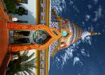
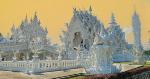
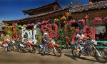
Chiang Mai The first days in Chiang Mai I look the Flower Festival, make some small tours and look the temples.
The temples in the nightime much more better than in the daytime but don’t forget moskitospray.
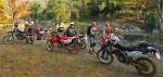
After the festival i rent a CRF 250 from POP for 650Baht/day and pay him 2 weeks. POP has now about 600 motorbikes and he is the biggest in asia but always very friendly when I see him.
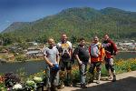
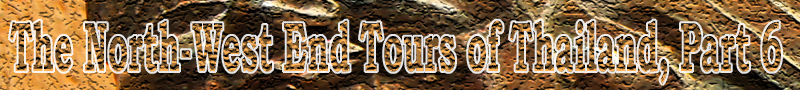
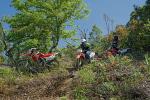
My first enduro-week i drove alone for look something new and take pictures. The second week i drove with 4 friends.
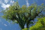
Doi Suthep - Huay Ting Tao Lake When I stay in Chiang Mai I drove the dirt road to Huay Ting Tao with stop over at coffee farm and a cheap lunch at the Huay Ting Tao lake. The tour start in Chiang Mai, up to Doi Suthep, drive the way to Doi Pui, before Doi Pui turn right, short stop at coffee farm, dirt road down to Huay Ting Tao. A poppy flower in Doi Pui
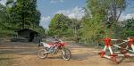
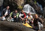
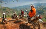
Dirt road near the coffee farm with my friends
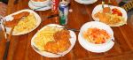
Restaurant on the Huay Ting Tao Lake, good and cheap thaifood
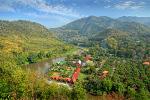
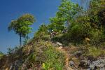
Mon Charm Garden and Rock Tower Another day to Mon Charm Garden and Rock Tower >>very nice places << From Chiang Mai to Mae Rim (107), then turn left (1095), after a few kilometers turn right and drive a small curvy street up on a mountain, near the top turn right and follow the signs to Mon Charm Garden. From Mon Charm Garden follow the dirt road to the Rock Tower. Here the map:
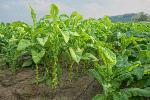
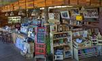
This area is coming up very popular for thai-tourist with many camping-resorts, restaurants and strawberry fields. This one with tent for rent is brand new. I stop for a coke and mama soup.
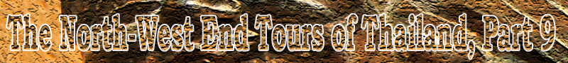
Some nice bungalow resorts
This one look like a tent but it is made with concret
Chaeson National Park Next day to Chaeson Park about 60km east of Chiang Mai, a lonely road with nice places.
In Chiang Mai drive the road to the river and on the big road to Chiang Rai .
-km 18 Doi Saket, keep left on the 118 to Chiang Rai.
-km 18,2 Gasoline station.
-km 29,6 nice temple left side
-km 46 Pang Faen
-km 47 Sharp turn right (after a concret bridge and a left curve). N19.01631 E099.30457
-km 47,8 Happy House Resort. Now up on the mountainroad.
-km 55,8 Temple at 1078m. N18.99274 E099.34460
-ca. km 234 turn right up (Sign „Skyline Adventure“) and follow the street (keep left) to the treehouse N18.95127 E099.33418
- km 67,8 back on the mainstreet.
-km 71,7 Big fork, keep left
-km 102,6 Barrier
-km 107 Turn right to Chaesorn NP.
-km 109,3 Entry counter, if you want look the waterfall pay 200 baht, if you want only passing tell them and you not pay (but NOT stop in the park).
-km 112,8 Fork, keep right
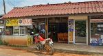
-km 123,6 Small village with gasoline and a small coffee shop (25 baht for coffee). After the village fork, keep left down
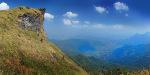
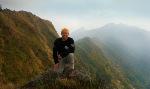
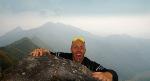
-km 129,6 Kew Fin Viewpoint parking, in a few minutes walk up to the top on 1517m.
After the road goes down, be careful because sometimes stepy.
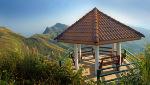
-ca. km 136 a nice wood cafe on 1083m with terrace and cake. Coffee Cake is 65 hot capu is 50 Baht. N18.86579 E099.35553
I love this building, Mae Kampong KP Resort
-km 134,3 End of the stepy mountainroad at a top hotel.
A nice old temple
-km 138,3 Hotelruine, never built finish.
-km 139,7 Tharnthong Lodge
-km 140,8 Small thai-restaurant.
-km 143,9 Turn right.
-km 153,1 At the highway turn left.
-km 155,4 Here you can turn left to some small lake and a diary farm with goats and deer.
-km 174,7 back at the highway, turn left
-km 195,7 Bierstube Chiang Mai at 18.20 p.m.
Forest Temple Wat Luang Khun Win The last trip goes to Wat Luang Khun Win, the beautiful wood temple in the forest of Samoeng. This one is amazing and I know it from this forum. The way: Drive to Samoeng, on the T in Samoeng turn left, after a few kilometers only dirt road and you will pass a few small poor villages. GPS 18.714890, 98.714688. Now near finish built.
Now they make a new construction
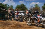
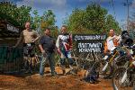
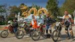
5 guys from Chiang Mai via Wat Chan to Mae Hong Son The first day only around Chiang Mai for check bike and driver. The next day i must wake up early because my bike need a new tire. About 9.00 o clock we start to Mae Hong Son. First on the big road to Mae Rim, turn left to Samoeng. In Samoeng turn right and now on the small streets and dirt roads via Wat Chan to Mae Hong Son, about 230km. The street is very good now and the built new tamrac roads near Wat Chan. The way from Chiang Mai:
-km 18,6 Mae Rim, turn left to Samoeng.
-km 42,2 Viewpoint on 1078m
-km 48,3 turn right to Samoeng.
-km 53,7 Samoeng T, turn right.
-km 55,8 Gasoline station. After the gasoline station short turn right and keep left on the fork (follow the mainroad).
-km 58,9 a village, turn left.
-km 62,3 Dirt road to a temple up
-km 65,4 Back on the mainroad from the temple.
-km 75,4 Khun Khan Nationalpark.
-km 84,7 Bigger village with restaurant.
-km 115,9 until here tamrac road, now dirt road
-km 119,5 new tamrac road for a few kilometers
-km 130,1 Triangle, keep right
-km 140,2 bigger village
-km 149,9 at 12.15 Uhr Wat Chan. When you turn right then you see after 20m a small restaurant (not this one on the corner, the next one). Drive to the other way and after 150m you see a cheap gasoline station on the left side.
-km 160,7 Fork in the village, keep right.
-km 196,1 um 14.11 Uhr Bandongsamuen village (with small gasoline station)
-km 223,0 now tamrac
-km 227,3 Checkpoint
-km 230,2 Mainroad, turn right.
-km 237 Mae Hong Son.
We stay in Mae Hong Son Guesthouse Bungalows, a nice quiet place with a friendly woman owner. Now she have only bungalows for 400-500 baht, the old cheap rooms are broken. The guesthouse is about 1km from the center. GPS 19.304457, 97.957910
In Mae Hong Son we saw the Road to Mandaly Rally. Old cars drive a verly long way, I can’t believe that. „The Road to Mandalay Ralley” goes from Singapore to Malaysia, Thailand and Burma, The Road to Mandalay 2015 . After a few minutes internet searching we found the cars from the gasoline station .
The red car with nr. 17 is Phil Garratt(GB) and Kieron Brown(GB) and the car is a 1937 - Chevrolet Fangio Coupe with a 3860ccm engine.
Outside a old car but inside with good equipment
The blue Volvo PV 540 with nr. 37 was built 1958, Denis Wilson(IRL) / Jill Wilson(IRL), a 1796ccm engine.
The white Jaguar MK1 with nr. 40 was built 1959, Daniel Spadini(CH) / Alexandra Spadini(CH), a 3442ccm engine.
The blue Jaguar XK150 with nr. 35 was built 1958, Syed Budriz Jamalullail(MY) / Syed Haizam Jamalullail(MY)/Aubry Mennesson(F), a 3442ccm engine
If you want to drive their way here is the plan: The Route | The ERA Road to Mandalay
Day 1: Raffles Hotel, Singapore to Desaru. 323 kms
Day 2: Desaru to Kuantan. 402 kms
Day 3: Kuantan to Cameron Highlands. 430 kms
Day 4: Cameron Highlands to Kota Bharu. 440 kms
Day 5: Kota Bharu to Georgetown. 450 kms
Day 6: Rest Day - Georgetown
Day 7: Georgetown to Trang. 385kms
Day 8: Trang to Khao Lak. 463 kms
Day 9: Khao Lak – Rest Day
Day 10: Khao Lak to Chumphon. 340 kms
Day 11: Chumphon to Kanchanaburi. 558kms
Day 12: Kanchanaburi to Kanchanaburi. 372 kms
Day 13: Kanchanaburi to Phetchabun. 525 kms
Day 14: Phetchabun to Phrae. 422kms
Day 15: Phrae to Chiang Mai. 408 kms
Day 16: Chiang Mai - Rest Day
Day 17: Chiang Mai to Mae Hong Son. 315 kms
Day 18: Mae Hong Son to Mae Sot. 394 kms
Day 19/20: Mae Sot to Myawaddy to Mawlamyine. 155 kms
Day 21: Mawlamyine to Naypyitaw. 455 kms
Day 22: Naypyitaw to Inle Lake. 273 kms
Day 23: Inle Lake to Mandalay. 251 kms
Day 24: Mandalay to Bagan. 237 kms
Day 25: Bagan to Rangoon. 587 kms
Day 26: Shipping Day Total: 8185km
Mae Hong Son: Rak Thai and Pan Ung Nice tamrac tour to two chinese villages near burma border.
First a stop on a waterfall
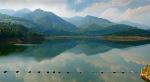
Pan Ung Lake
Rak Thai, the mountain behind us is the border to burma
A border picture
In the village Rak Thai, they sell everywhere tea
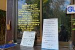
In this restaurant we eat soup and we thought expensive because 150
baht, no, 150 baht for a big bucket, but we order 5 soup ……
Mae Hong Son: Jabo Tour This is a very quiet tour. First the 1095 direction to Pai.
After 50km the viewpoint. Km 56,4 turn left to Jabo on the 1226. On the
next fork keep left and follow the street until the end on the myanmar
border on 1192m.
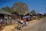
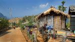
A street with a nice landscape. Many small poor villages in this area
with people eat betelnut.
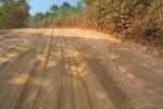
If you see something like this be carefull, it is very bad to drive on
this street with the powder.
On the way back you can drive to the
Diamond Cave, Coral Cave and Mae Lana Cave, only with guide. My tour was
about 230km.
Mae Hong Son: MHS – Wat Chan - Pai Loop -9.21 Uhr Start, drive the mainroad to south.
-km 6,4 Turn left
-km 9,2 Checkpoint
-km 40,5 at 10.32 Uhr in Bandongsamuen
-km 51,5 at 11.06 Uhr Fork, keep left
-km 60,1 at 11.27 Uhr on 1668m
-km 86,7 at 12.20 Uhr Wat Chan, short stop for a soup and gasoline.
-km 117,5 Hot Springs
-km 118,9 Left to the concrete Mainroad Haupstrasse
-km 133,5 Turn left to Pambok Waterfall.
-km 157,8 Mhor Pang Waterfall
-km 163,9 at 15.08 Uhr Mainroad.
-km 184,6 at 15.32 Uhr on 1432m Kiu Lom Viewpoint.
-km 202 at 16.02 Uhr Phang Mapha = Soppong,
-km 268,2 um 17.35 Uhr Mae Hong Son
The full loop without waterfall is about 250km.
I believe it was 15 years ago when I drove for the last time from Wat
Chan to Pai, a very bad road. Now it looks like a small highway it is
possible with every car. Every year i stop in Pai for Capucino and cake
in Cake go o, but this year to expensive because much more than in my
home, a butterbread is now 85 baht…
Thaton: Newton Guesthouse, Wat Thaton, Mae Salong The tour from Mae Hong Son was hard because at 8.00 o clock only 15C. First we use the 110km tamrac road from MHS to Pai and then 160km dirt road with short parts of tamrac, the last 60km tamrac
road to Thaton, total 330km, 8hours.
Here a short stop near Doi Ang Khang
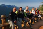
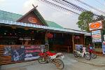
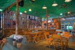
Thaton is a good place for nice enduro tours to collapsed road in the west of Thaton, Mae Salong, Wawi/Doi Chang, the river dirt roads to Chiang Rai and more. It is a real cheap thai-city not a touristplace as Chiang Mai or Pai. A big Leo in Newton Gh is only 65 baht.
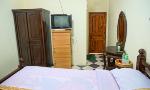
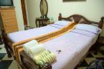
In Thaton i choose 2 times the new Newton Guesthouse witch is on the old
place of Kwans Gh in front of the bridge, 1min walk to 7/11. Nice new
rooms (only 4) with TV, Hot water for 350 baht. GPS 20.060860, 99.361658
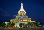
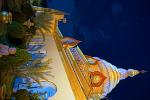
The Wat Thaton is one of the best temples in Thailand and a “must see place”, don’t forget to visit daytime AND nightime!!
They built something new
Doi Mae Salong is a mountain-city witch offers many dirt roads and curvy tamrac mountain roads.
It is a chinese dominated city with many tea farms. One of my favorite dirt roads here is the small short path from Ja Bu Si Village to the 1089. Outlook to the 1089:
Another crazy dirt road goes near the mountain temple down to the city.
This path is a little bite difficult as you can see in this video of my
friend:
Here pictures from this path
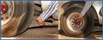
Crazy Thailand: The garlic pickups, a original pickup can put only 2000-3000kg, but with a truck axle and reinforced springs can put 4000kg. I don’t know if they modify the brakes too……
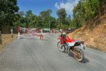
Thaton: Collapsed Road This year I tried the Collapsed Road from the north and from the south side but it was impossible
to pass the army-checkpoint. First from the north side, it start about 300m from 7/11 in Thaton and goes up.
From the north side I can pass the first army-checkpoint (Plate register, Passcopie), about 13km from
Thaton. But 3km after the Doi Lang Camp Ground (1717m) on 2029m the army say no.
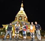
First a short temple visit, for lucky
Thaton
Doi Lang Camp Ground with a wonderful view on 1717m and fresh air
Nice trees in the high mountains
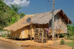
Down near Thaton, a bamboo house with sat tv
Then I drove down and to the other side via Mae Mao Dam, but the same.
Back in Thaton after 190km.
A nice road but I not saw the repaired collapsed road :-(.
Mae Mao Dam
Checkpoint on the south side
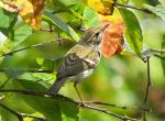
Many people come here to look the rare birds, but this one very small
Thaton: Doi Chang, Wat Rong Khun, Dream Gh We start in Thaton the way to Chiang Rai, after a few kilometers turn right to Huay Khum
Resort. I nice road through the mountains to Wawi, the hidden city between the mountains. Wawi is one of the biggest old citys that I know and still old style. From Wawi the way to Doi Chang, a curvy mountain road.
Doi Chang has a very beautiful landscape and most of the people here akha who work in the coffee farms. On Doi Chang now are some good resorts.
After a coffee we drove up to the top on 1700m. Coffee Farm Shop
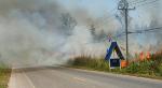
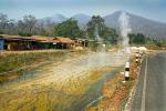
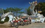
Then down on the east side to Wat Rong Khun. But first cross this fire
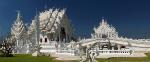
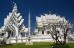
The Wat Rong Khun (White Temple) looks good. Something is broken but still nice to see this building
From Wat Rong Khun 30 km on the river to My Dream Guesthouse for the best falang food for only 120 baht.
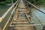
The old suspension bridge (Aleaja Bridge, constructed 2541means in the year 1998) is danger now, we
only walk on the bridge. 2 years ago I use it with my Honda CRF 250.
We follow the dirt road witch has some small water crossings and near the end a stepy mountain. Short stop on the river
The dirt road ends at the 1089 junction to Mae Salong.
<p>Many time i try to post the next part of the trip but this forum software not accept the bulletin boards formating commands like "img" for picture or "color". Can anyone help? What commands used in this software?</p>
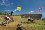
Thaton to Phu Chee Fah Phu Chee Fah is the border-mountain to Laos. From Thaton to Chiang Rai and then to the
east. It is a very nice place with only a few foreign tourist but sometimes many thai tourist. I choose the same resort as i had 2 years ago, the Phu Chee Fah Lodge. This resort is about 9km from Rom Fah Thai, the village where the street goes up to the top. This bungalow was 500 baht include a thai-breakfast.
Then back to the mountain
On the next day a drove up to Phu Pha Sawan Viewpoint, the road goes up 10m before the resort. The last 10min must walk.
A illegal fall to Laos
And then to Pha Tang, about 25km in the north, but the same mountainchain. A nice curvy road, everytime between 1400-1500m. From parking to the top only 10min walk. The fantastic view, left side Laos with the mekong river
Random I think we all like to look the crazy, funny bikes in Thailand, so I will show you some of them (I
write some price because difficult to see in the photo).
This one is a shop in Pattaya, Soi Buakhao
This one at a tattoo shop in Soi Buakhao, Pattaya
Private bike in Pattaya, but he want sell
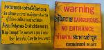
WARNING Pattaya police not accept National Driving License, every tourist must have a
International Driving License, those caught will pay 400 baht.
I was very disappointed this year of Koh Larn, every year more waste
WARNING: Bus Don Sak Pier – Surathani trainstation, Bad game
My friend had a ticket from phangan 2000 for the bus from don sak to surathani trainstation. He had only a
small bag but the driver said he must put in the stowing box and then he do it ... When he arrived he saw the
bag of him was open and another one too. He check and saw the mobilephone was stolen. He and another
guy start to shout with the driver. Then the driver jump in the bus and ramed the guys with the bus. My friend
push the window with his arm and the window split. They report it to the police but nothing.... He report to
Phangan 2000, they said nothing happen….
Smiley Lake House, a low price raft house resort of my friend
I would like terminate this thread with a few beautiful pictures of Surin Islands, near Khao Lak. You can rent a bungalow for ~2500 baht or a tent for 500 baht. I had a lot of fun with my thaifriends there. The speedboat is 1600 baht for go and back (60km oneway) https://www.google.de/maps/place/Ko+...c677f4edc4059e
This site uses cookies to help personalise content, tailor your experience and to keep you logged in if you register.
By continuing to use this site, you are consenting to our use of cookies.


")