Wet Weather Alert

DavidFL

0
Staff member
Subscribed
Jan 16, 2003
14,486
5,320
113
70
Chiang Khong
www.thegtrider.com
Wet season 2016 - August

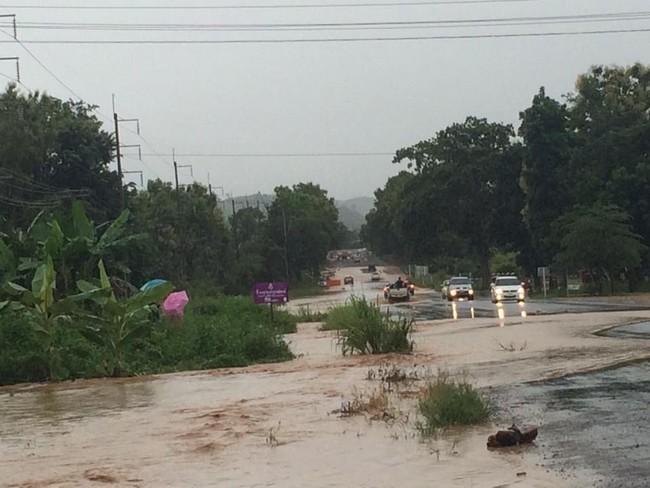
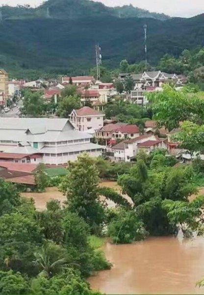
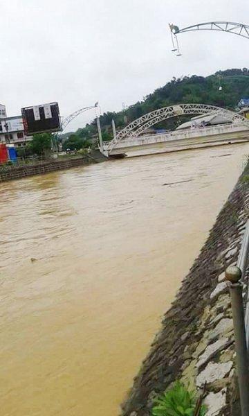
It looks like the wet season has really kicked in at last with lots of local flooding the last week

Pai Thailand

14034911_164186817343628_3828968918195253789_n.jpg


Pua Thailand
14046007_10155121742343989_4822566496287564116_n.jpg


Oudom Xai Laos
14031101_10153786145171404_2036311072_n.jpg


Xam Neua Laos
13901386_914556718690167_2305775085742465037_nB.jpg


There is a wet weather storm flooding alert in place for the next few days

People should beware of the severe conditions as well as continue rain and isolated heavy rain in Mae Hong Son, Chiang Mai, Chiang Rai, Phayao, Nan, Phrae, Lamphun, Lampang, Tak, Sukhothai, Uttaradit, Phitsanulok, and Phetchabun. The monsoon trough lies across Myanmar, the upper North of Thailand and Laos to the low pressure cell in Tonkin Bay. The strong southwest monsoon prevails across the Andaman Sea, the South and the Gulf of Thailand.

The strong wind waves in the Andaman Sea and the upper Gulf of Thailand are likely 2-4 meters high. All ships should proceed with caution, and small boats keep ashore until 19 August.

This advisory is in effect on 15 August 2016, at 11.00 a.m.

http://www.tmd.go.th/en/list_warning.php

Check out this satellite picture as well
Thailand Enhanced Weather Satellite Map - AccuWeather.com
 

DavidFL

0
Staff member
Subscribed
Jan 16, 2003
14,486
5,320
113
70
Chiang Khong
www.thegtrider.com
Nan at Wat Phumin
13920954_10154390651744598_615786206512483938_n.jpg

flooding in Nan: Nan hit by floods, subsidence after heavy rain

Chiang Kham
1933565.jpg

flooding in Chiang Kham & Pong: Floods inundate 2,900 houses in Phayao

Wherever they've been growing corn on the mountain sides there is no water retention & the water comes flooding down.

The latest wet weather alert
Reduction of rainfall is possible for the North. Still, there remains continual and heavy rain over following provinces: Mae Hong Son, Chiang Mai, Chiang Rai and Tak.
During 18-20 August, the low pressure will intensify and cover upper Laos with more rain over the North and the Northeast of Thailand while another round of heavy rain outbreaks will be possible. All people should beware of the severe conditions.
The strong winds in the Andaman Sea and the upper Gulf of Thailand lead to waves likely 2-4 meters high. All ships should proceed with caution, and small boats keep ashore until 20 August.
This advisory is in effect on 16 August 2016, at 11.00 a.m.
http://www.tmd.go.th/en/list_warning.php
 

DavidFL

0
Staff member
Subscribed
Jan 16, 2003
14,486
5,320
113
70
Chiang Khong
www.thegtrider.com
Next one inbound from the east: Vietnam - China Sea

GTR017.jpg


Tropical Storm “DIANMU”

over the upper South China Sea and Strong Wind Waves"

At 03.00 a.m. on 18 August, the tropical depression in the upper South China Sea upgrade to tropical storm “DIANMU”was centered the east of Hainan Island, or latitude 21.0 °N, longitude 111.0 °E, with sustained winds about 70 km/hr. It is moving west with maximum sustained winds about 10 km/hr. It is expected to move to Tonkin Bay by today (18 August). More rain is likely over Thailand with isolated heavy to very heavy rain in the North and the Northeast. Provinces include Loei, Nong Bua Lam Phu, Nong Khai, Bueng Kan, Udon Thani, Sakon Nakhon, Nakhon Phanom, Ubon Ratchathani, Mae Hong Son, Chiang Mai, Chiang Rai, Phayao, Nan, Phrae, Lamphun, Lampang, Uttaradit, Phitsanulok, Phetchabun and Tak during 18-20 August. People should beware of the severe conditions.

The strong wind waves in the Andaman Sea and the upper Gulf of Thailand are likely 2-4 meters high. All ships should proceed with caution, and small boats keep ashore until 21 August.

No. 5 Time Issued : August 18, 2016

http://www.tmd.go.th/en/list_warning.php