Nanthaburi National Park, Nan

Oddvar

0
Subscribed
Mar 18, 2013
534
358
63
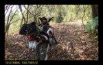
4 days of puttering around in Nanthaburi National Park in Nan.
Most of the area is farm land, but some areas is pristine.
Nice trials all over the area. Some mapped, some not.

Nanthaburi%20National%20Park%201-L.jpg

A couple of dead ends, but most trials goes through to other trials. Once over the mountain from Santipap, most trial will lead to 1082.

Nanthaburi%20National%20Park%202-L.jpg
A lots of cows were grassing in the area. New barbed fences indicate that this is big business.

Nanthaburi%20National%20Park%203-L.jpg

Just about to join up with a mapped track. This is about 5km south of 1082 in the eastern part.

Nanthaburi%20National%20Park%204-L.jpg

This is all you can see from 1082.

Nanthaburi%20National%20Park%205-L.jpg

Chinese money here as well. On the way to Ban Santipap.

Nanthaburi%20National%20Park%206-L.jpg

This is an interesting 3-way intersection. The one to the right lead to the valley to the east, and a road back to the Nan road as well as up to 1082.
The one in the middle curves around the mountain going west, and join up with the farm roads to the west.
The one to left I will leave to next time, however, there is many promising trials on the west side of this mountain.

Nanthaburi%20National%20Park%207-L.jpg

Time for lunch and a nap.

Nanthaburi%20National%20Park%208-L.jpg

Thanks to rain the night before the air was fairly clear. Note the land slide in the centre of the picture. That served as a landmark. It is just south of 1082 and the trail which took me to 1082 yesterday.


Nanthaburi%20National%20Park%209-L.jpg

Dead end in the "eastern valley". Google Maps shows more roads here, but there are none, yet!

Nanthaburi%20National%20Park%2010-L.jpg


Nanthaburi%20National%20Park%2011-L.jpg

The land slide close up, or as close as I could ride.

Nanthaburi%20National%20Park%2012-L.jpg

The next day I checked out the trials around Ban Santipap. They did only lead into Dead end Valleys. With a new tyre I would have checked this out. Trust me, It's way steeper than it looks like.


Nanthaburi%20National%20Park%2013-L.jpg

The trial north of Ban Santipap ended up in this stream. I checked it out from the west the day after. Very rugged terrain in the area, but you never know. Need to checked out..


Nanthaburi%20National%20Park%2014-L.jpg

More burning and more crops.


Nanthaburi%20National%20Park%2015-L.jpg

This is one of the trail on the west side of the mountain. Looks like a "disused" road/trial. Turned in to a single track a bit further down. Need another go here.


Nanthaburi%20National%20Park%2016-L.jpg

This is the end of the "middle" track and connecting to trial and farm roads in the western valley.

Nanthaburi%20National%20Park%2018-L.jpg

This was too steep for me on my worn down tyres. This is not more than 800m from where I ended up in the stream yesterday. But the elevation difference is about 500m. Will check this out with a fresh set of tyres.


Nanthaburi%20National%20Park%2019-L.jpg

Yes, It's all about the corn. For animal food.


Nanthaburi%20National%20Park%2020-L.jpg

Not so many river crossing in this area. This one was a perfect lunch spot.

Edited picture links to SmugMug.
 
Last edited:
  • Like
Reactions: Jurgen
Sep 19, 2006
2,393
374
83
62
www.chiangmai-xcentre.com
Very Nice Oddvar,
I always said as We Blast around Nan on Our Road Bikes there must be an amazing amount of Trails to Explore around such a Vast Area. Great Stuff. A Beautiful Countryside!
 
Mar 30, 2010
2,136
300
83
Nice one.. Have to park KLX II up in Nan and do some exploring too.

Great stuff.. really interested to see the trails. As Bungy said.. When on road bikes we zoom right on past.
More than a few times I wanted to head down a trail.. The Ninja would not have thanked me

Cheers
Brian
 

Oddvar

0
Subscribed
Mar 18, 2013
534
358
63
This loop will be over 50% dirt if the trial in red can be confirmed. I need some riding buddies to do that one as the start looks to be a bit touch. Or maybe I was too lazy to walk and have a look before turning around.
The trail from the "red" trail and going east a really nice trial. Following the ridges, and bamboo forest.
Nan is not just for racing street bikes, so much unexplored areas left.

Nan North Dirt tracks to-from.jpg
 
Last edited:

Oddvar

0
Subscribed
Mar 18, 2013
534
358
63
After more looking for the "non existent" 1172 I came back to 1082 and tried another trial leading to Ban Santipap.
Some sections of this trial are not in use, but for a CRF and fairly new tires, it was a nice ride.
Nanthaburi Westeren part.jpg

It does not look like there are anymore trials to the south of this one. But as progress is progressing here, who knows in a few years.
Nanthaburi NP SW 1.jpg

Most of this trial is in the woods.
Nanthaburi NP SW 2.jpg

But "progress" will soon claim this trial too.
Nanthaburi NP SW 3.jpg

Strange to ride here. Vast new farmland to the north and pristine jungle on the south side of the trial.
Nanthaburi NP SW 4.jpg

There is a lot of new farm roads, but they all lead up to 1082 or towards this trial.
Nanthaburi NP SW 5.jpg

More burning.
Nanthaburi NP SW 6.jpg

The trial followed several ridges.
Nanthaburi NP SW 7.jpg

Nanthaburi NP SW 8.jpg

The condition of this bridge is not too good. It leads up to a Ranger station.
Nanthaburi NP SW 9.jpg

By cutting down some branches I got around this fallen tree. No traces of traffic in this part of the trail.
Nanthaburi NP SW 10.jpg


Nice and cool in the shades of the larger trees.


Edited links to save on GT-R
 
Last edited:

Oddvar

0
Subscribed
Mar 18, 2013
534
358
63
A update on 1172.
This time I tried from the North. As in the southern part evidence of construction of this elusive road was evident. The jungle has reclaimed about 6 km of this road.
The locals working the land, if burning can be called work, confirmed that "long time" ago it was possible to get thru on a motorbike. They did not mention mines, tigers or communist as the Rangers station in the south say. But they did mention landslide.
1172 Map.jpg

About 6 km as the crow fly is "gone".

1172 North 1.jpg

A tiny piece of tarmac is evidence that there was a construction of a road here once.

1172 North 2.jpg

In the southern part there is two "bridges" like this.

1172 North 3.jpg

This is as far as I got this time.

1172 North 4.jpg

But as progress comes to Doi Pha Chang Wildlife preserve area there might be a need for a road for the hunters.
I saw 2 squirrels and 4 men with long rifles. Soon they might call it "Old Hunters Preserve Area"
 
Last edited:

Oddvar

0
Subscribed
Mar 18, 2013
534
358
63
This is what Nanthaburi National Park has revealed this “Dry Season”.
The only significant trails are the “Suan Ya Luang” and Doi Pha Chang.

2015 New trails Nanthaburi copy.jpg


Doi Pha Chang is a Wild life preserve area but don’t expect to se much of that, however, you will se many locals with rifles. I saw some with new rifles and scopes too. A sniper worthy?

Suan Ya Luang came as a big surprise. A nice ride up from Ban San Charoen through fruit trees and into the jungle. The top is about 1600 MSL and fairly bare with a very nice view in all directions. It even got a camping ground that is staffed during holidays in the peak season.
Many large trees falls down on the west side, so make sure you have fuel to turn around!

Do Wao is another peak around 1600 MSL, not part of a loop but a really nice ride with continually changing nature. There is a camping ground at the Forrest ranger station a few km of 1082.

Colin found the “Yellow loop” at the south side. We tried this one earlier this year but one bike did not manage to get through the tall grass.
Later this year this trail was cleared by the locals. It was not cleared last year.

All “significant” trails have been uploaded to OSM.
 
Last edited:

DavidFL

0
Staff member
Subscribed
Jan 16, 2003
14,455
5,287
113
70
Chiang Khong
www.thegtrider.com
Oddvar;304981 wrote: A update on 1172.
This time I tried from the North. As in the southern part evidence of construction of this elusive road was evident. The jungle has reclaimed about 6 km of this road.
The locals working the land, if burning can be called work, confirmed that "long time" ago it was possible to get thru on a motorbike. They did not mention mines, tigers or communist as the Rangers station in the south say. But they did mention landslide.
1172%20Map.jpg

About 6 km as the crow fly is "gone".

1172%20North%201.jpg

A tiny piece of tarmac is evidence that there was a construction of a road here once.

1172%20North%202.jpg

In the southern part there is two "bridges" like this.

1172%20North%203.jpg

This is as far as I got this time.

1172%20North%204.jpg

But as progress comes to Doi Pha Chang Wildlife preserve area there might be a need for a road for the hunters.
I saw 2 squirrels and 4 men with long rifles. Soon they might call it "Old Hunters Preserve Area"
The bridges & Doi Phachi....I found some history, that I remembered from years ago, but it has taken a long time to find confirmation in English on the web

In late 1999, ethnic minority Mien farmers in Phayao Province of Thailand’s north used drastic measures to defend their farmland and their rights. Having petitioned all levels of provincial and national authorities for years, the farmers resorted to an act of sabotage, burning down several buildings at a wildlife sanctuary’s headquarters. At no time did the protesting farmers convey themselves as ethnic minority peoples. In their letters, in the confrontation with sanctuary staff, and at the many meetings that followed the burning, the farmers presented themselves as national—Thai—in language, manners, aspirations, frustrations, and claims on the state

In 1981, the Royal Forestry Department established a Wildlife Sanctuary in the sub district of Pha Chang Noi, in Pong district of Phayao province, to close off a former area of CPT insurgent bases in the forest. By 1992, the RFD declared five of six registered villages illegal and announced their eviction. Nothing happened at the time. After the protest in 1999, there was still no change. In 2003, the RFD declared the whole sub district a Primary Watershed (Class A1); all settlement and farming was illegal and should be erased. Judging from a visit in 2005 and from correspondence in late 2008, the villages are still in place and farming continues
 

Oddvar

0
Subscribed
Mar 18, 2013
534
358
63
Nanthaburi never stop to surprise me. A couple of picture from a recent ride. I had reason to believe a 'new' trail would hook up, and it did.
2017-4 Nanthaburi NP 1.jpg

The trial starts at this location. A new sign for elephants, monkeys and tigers has been set up since I was here last. Fake news I suppose.
2017-4 Nanthaburi NP 2.jpg

The farmland soon gave way to the pristine jungle in this area.
2017-4 Nanthaburi NP 3.jpg

So far, so good. The trial I hopes was there is here. Let's hope in connects up.
2017-4 Nanthaburi NP 4.jpg

In and out of the jungle, and in and out of clearings. Just to let you se the beauty of this place. The overnight rain did clear some of the haze.
2017-4 Nanthaburi NP 5.jpg

Fo some reason 'they' clear out the tracks every other year. Don't know why, but I do appreciate it.
2017-4 Nanthaburi NP 6.jpg

Well, not ever track is cleared out every year.
2017-4 Nanthaburi NP 7.jpg

How about riding here. Nanthaburi NP got it all.
2017-4 Nanthaburi NP 8.jpg

This is from the Ranger Station and camping ground looking north toward Song Kwae.
2017-4 Nanthaburi NP 9.jpg

On the home stretch, or not.
2017-4 Nanthaburi NP 10.jpg

I've spent a lot of time looking for trial out of this valley, so far i've not found any trial.
2017-4 Nanthaburi NP 11.jpg

They year they have really cleared out the south east part of the 'National Park'.
2017-4 Nanthaburi NP 12.jpg

I had to go and check out a trial Brian and me checked out two years ago that ended in a Bamboo forrest. This time I did not get that far. This is 100m from our 'record' two years ago.
2017-4 Nanthaburi NP 13.jpg

They build these shelters on windy spots with a nice view. Nice for lunch and a nap.
2017-4 Nanthaburi NP 15.jpg

After 4 years the CRF if holding up in an impressive way. A 48 rear sprocket compensate for the low power. And after
90k km it still runs like a clock.
Nan wikipedia.jpg

If this is the government point of view there is not much hope for the beautiful and important jungle in Nan.
 

Attachments

  • 2017-4 Nanthaburi NP 14.jpg
    2017-4 Nanthaburi NP 14.jpg
    135.6 KB · Views: 280
Last edited:

DavidFL

0
Staff member
Subscribed
Jan 16, 2003
14,455
5,287
113
70
Chiang Khong
www.thegtrider.com
R1172 that bridge that was burned down the Hmong not long after it was built.

upload_2020-3-28_15-44-40.png


this was early - mid 1980s I think from memory. I'm trying to find my notes & will update.

The road into Doi Phachi, the Hmong village
upload_2020-3-28_15-46-12.png


upload_2020-3-28_15-46-29.png


upload_2020-3-28_15-46-41.png


There's another GTR report from Ian, about this old communist area here
Communist Village & Natural Wonders Of Phayao...

There's also another report with photos of those communist memorials & graves.
Return to Nan & back to the future?
A few bits on the end of this report.

I hope you can get out there again Oddvar.
I'm chasing up the story about the communist memorial at San Charoen on the other side & will report once I get the info.
 
Last edited:
  • Like
Reactions: Oddvar