Roadbook software
- Thread starter Azoulay
- Start date
You are using an out of date browser. It may not display this or other websites correctly.
You should upgrade or use an alternative browser.
You should upgrade or use an alternative browser.
Don't know if this what you want but have a look at the Road Book Editor at http://rbeditor.valleyfield.se/en/about.php The software is free.
Hi Auke,
Thanks my friend, it's exactly what I am looking for and I already download this software, issue is ... It does NOT work thus I am looking for someting similar which works even an older version.
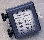
I think this is typically the kind of usefull software to use for trips over LOS, coupled with a GPS or a Trip Master for those who remember, that's idle to trace roadbooks.
Laurent, your posts made me curious. I downloaded RBEditor 2.4.2, but it comes without a manual, so I don't know how to use it - or what a roadbook is, for that matter. :?
Can you explain me the use in a few brief words please? Thanks!
Can you explain me the use in a few brief words please? Thanks!
Hi Friend Beattheswiss,
In fact this software is purposed to realise roadbooks which means to realise a serie of instructions in order to arrive between different locations. It is usefull for rallies, enduroes and all other trip.
Simple and efficient, on top you should be able to read it and recognise instructions when sitted next to the pilote driving fast in a car or alone on your bike while riding.
Hope it helps.
I have never heard the term "roadbook" either, but it sounds like a detailed route plan, such as generated by mapping programs like Mappoint or even Google Maps. I had many of these type of programs in the UK, but in Thailand only have the maps which work on the GPS and not on the PC.
The GPS gives you a route of course but it is difficult to view complete on the GPS, but one can download to the PC and view there, but it is clumsy.
If anyone has good Thai maps that can be used on the PC and used to generate routes, and record tracks I wuld be interested.
At the moment I use Thinknet PC map to plan and to print selections to take with me on the road. I import small areas into a shareware program called Oziexplorer, I calibrate these and can then use Oziexplorer to recod tracks from the GPS and also to plan routes and feed back to the GPS, the painful bit is the map calibration and one can only do an area of say 100 km by 100km if one wants to retain sufficient detail.
Any better ideas for route planning on the PC that can be fed back to the GPS automatically.


